Laura became a hurricane Tuesday shortly after entering the warm and deep waters of the Gulf of Mexico, gathering strength on a path to hit the U.S. coastline as a major storm that could unleash a surge of seawater higher than a basketball hoop and swamp entire towns.
The National Hurricane Center projected that Laura will become a Category 3 hurricane before landfall, with winds of around 115 mph (185 kph), capable of devastating damage.
“The main point is that we’re going to have a significant hurricane make landfall late Wednesday or early Thursday,” National Hurricane Center Deputy Director Ed Rappaport said Tuesday.
The decapitating cross winds that killed Marco are not present, so there is little to keep Laura from turbocharging. Nearly all the computer simulations that forecasters rely on show rapid strengthening at some point in the next couple of days.
“The waters are warm enough everywhere there to support a major hurricane, Category 3 or even higher. The waters are very warm where the storm is now and will be for the entire path up until the Gulf Coast,” Rappaport said.
Laura passed Cuba after killing at least 11 people in the Dominican Republic and Haiti, where it knocked out power and caused flooding in the two nations that share the island of Hispaniola. The deaths reportedly included a 10-year-old girl whose home was hit by a tree and a mother and young son who were crushed by a collapsing wall.
Now forecasters are turning their attention the Gulf Coast, where up to 11 feet (3.4 meters) of sea water — storm surge — could inundate the coastline from High Island in Texas to Morgan City, Louisiana, the hurricane center said.
“We’re talking about something that’s on the order of 10 feet and that’s going to penetrate well inland,” Rappaport said.
On top of that, up to 15 inches (38 centimeters) of rain could fall in some spots in Louisiana, said Donald Jones, a National Weather Service meteorologist in Lake Charles, Louisiana — in the bullseye of Laura’s projected path.
“Whatever happens, happens. We’re going to roll with the punches,” said Capt. Brad Boudreaux, who operates a fishing guide service in Hackberry, Louisiana, near the Texas line.
The silver lining for U.S. coastal residents is that an earlier storm — Marco — greatly weakened and became a remnant just off Louisiana’s shore on Tuesday. Satellite images showed a disorganized cluster of clouds. It was relegated to what meteorologists call “a naked swirl,” Jones said.
The crew of a hurricane hunter plane confirmed that Laura became a hurricane with top winds of 75 mph winds (120 kmh) shortly after passing between the western tip of Cuba and Mexico’s Yucatan Peninsula. It was 625 miles (1005 kilometers) southeast of Lake Charles, Louisiana, heading west northwest at 17 mph (28 kmh).
The hurricane center warned people not to focus on the details of the official forecast, since “storm surge, wind, and rainfall hazards will extend well away from Laura’s center along the Gulf Coast.”
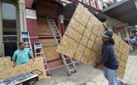
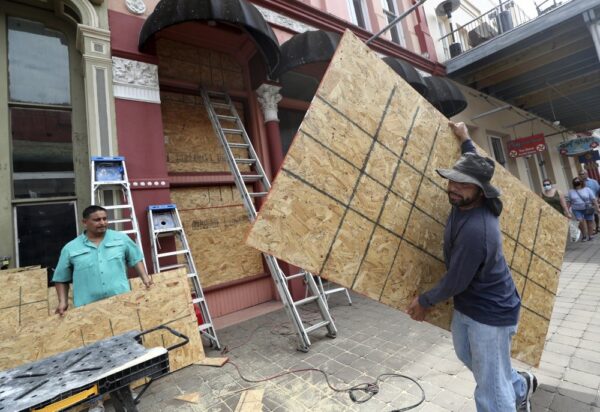
In Port Arthur Texas, Mayor Thurman Bartie issued a mandatory evacuation order for the city’s more than 54,000 residents starting at 6 a.m. Tuesday. People planning on entering official shelters can bring just one bag of personal belongings each, and must “have a mask” to reduce the spread of coronavirus, the order said.
“If you decide to stay, you’re staying on your own,” Bartie said.
The Associated Press contributed to this article